

'%3e%3cpath%20d='M12%2020.3333C16.6024%2020.3333%2020.3333%2016.6024%2020.3333%2012C20.3333%207.39762%2016.6024%203.66666%2012%203.66666C7.39763%203.66666%203.66667%207.39762%203.66667%2012C3.66667%2016.6024%207.39763%2020.3333%2012%2020.3333Z'%20stroke='%23F2F2F2'%20stroke-width='2.08333'%20stroke-linecap='round'%20stroke-linejoin='round'/%3e%3cpath%20d='M8.66667%2013.6667C8.66667%2013.6667%209.91667%2015.3333%2012%2015.3333C14.0833%2015.3333%2015.3333%2013.6667%2015.3333%2013.6667'%20stroke='%23F2F2F2'%20stroke-width='2.08333'%20stroke-linecap='round'%20stroke-linejoin='round'/%3e%3cpath%20d='M9.5%209.5H9.50833'%20stroke='%23F2F2F2'%20stroke-width='2.08333'%20stroke-linecap='round'%20stroke-linejoin='round'/%3e%3cpath%20d='M14.5%209.5H14.5083'%20stroke='%23F2F2F2'%20stroke-width='2.08333'%20stroke-linecap='round'%20stroke-linejoin='round'/%3e%3c/g%3e%3cdefs%3e%3cclipPath%20id='clip0_10282_1064'%3e%3crect%20width='20'%20height='20'%20fill='white'%20transform='translate(2%202)'/%3e%3c/clipPath%3e%3c/defs%3e%3c/svg%3e)


Detailed fantasy map of Trento and surrounding valley on aged parchment with sepia ink.
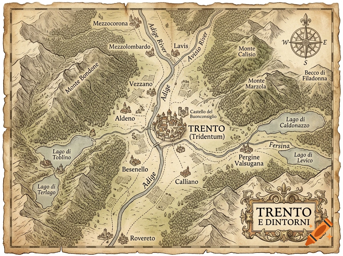
A hand-drawn fantasy-style map of Trento, Italy and its surrounding valley, rendered like an illustration from an old fantasy novel. Sepia ink and pencil linework on aged parchment, with hachure-shaded hills and cross-hatched mountain slopes in the old cartographer style. The Adige River winds north to south through the center of the map, passing through the walled city of Trento (drawn with small turret and castle icons), with the Avisio river joining it near the town of Lavis to the north, and the Fersina river flowing in from the east near Pergine Valsugana. Monte Bondone rises as a large forested massif to the west of the city; Monte Calisio and Marzola are smaller wooded peaks to the east. Small labeled town markers for Mezzocorona, Mezzolombardo, Vezzano, Aldeno, Besenello, Calliano, and Rovereto to the south. Lago di Toblino and Lago di Terlago to the west, Lago di Caldonazzo and Lago di Levico to the east. Hand-lettered serif place names, a decorative compass rose, a scale bar, and a torn-parchment border with an ornate title cartouche reading "Trento e dintorni." Muted earth-tone palette — sepia, ochre, faded green — no modern elements, no invented geography, weathered paper texture, fine ink linework, illustrative fantasy-map aesthetic reminiscent of Tolkien-style maps. See more
More images like this


